- Government Organisation
- Niger State Government House, Mu'azu Mohammed Road, Minna 920101, Niger, Nigeria
Niger State
Introduction to Niger State
Niger State, one of the 36 states of Nigeria was created out of the defunct North Western state on 3rd February, 1976. Situated in the North central geo-political zone, Niger State shares its borders with republic of Benin (West), Zamfara State (North), Kebbi (North-West), Kogi (South), Kwara (South West), Kaduna (North-East) and the FCT (South-East).
The State comprises 25 Local Government Areas grouped into 3 administrative zones: A, B, C with each zone having 8, 9 and 8 Local Government Areas (LGAs) respectively. In line with the constitution of the Federal Republic of Nigeria, two levels of government exist in the State; the State Government and the Local Government Councils.
With the merger of Borgu Emirate from the old Kwara in August 1991, Niger State is one of the largest states in Nigeria covering about 86,000km2 (or about 8.6million hectares) representing about 9.3% of the total land area of the Country. The State’s major rivers are: Niger, Kaduna, Gbako, Eko, Gurara, Ebba, Ega, Mariga and their tributaries.
The common fishes found in these rivers are: Nile Perch (Lates) Trunck fish, Cat fish, Osteoglosid, Tilapia, Synodontis, Tiger fish, Moon fish, Mormyrid and Electric fish. By the 2006 census, the State’s population is 3,950,249 comprising 2,032,725 males and 1,917,524 females. These represent the proportional share of 51.5% for males and 48.5% for females respectively. As opposed to a national annual growth rate of 3.2%, Niger State is growing at 3.4% annually.
The easily identifiable major ethnic groups are Nupes, Hausa, Gbagyi, Kadara, Koro, Bassa, Kamuku, Ingwai, Fangu, Kambari, Dukkawa, Fulani, Abewa, Bisan, Gungawa, Bauchi, Bariba, Urah, Boko, Bokobaro, Bauchnu, Achifawa, Dakarkari, Kakanda, Ganagana, and Dibo and numerous non native tribes. The major economic activity is agriculture: farming, fishing, and cattle rearing.
The other economic activities (though limited in scale) include banking, trading, transportation, local arts and crafts with Bida, the heart land of the Nupes, famous for its brass work. These activities constitute the means of livelihood of the people of Niger State in addition to public service.
Introduction
Niger is a state in the North Central region of Nigeria. It is the largest state in the country by area. The state capital is Minna. Other major cities are Bida, Kontagora and Suleja. Niger state was formed in 1976 when the then North-Western State was divided into Niger State and Sokoto State. It is home state of two former Nigerian military heads of state Ibrahim Babangida and Abdulsalami Abubakar. The Nupe,Adara, Gbagyi, Kamuku, Kambari, Gungawa, Hun-Saare, Hausa and Koro form the majority of numerous indigenous tribes of Niger State.
The state is named after the River Niger. Two of Nigeria’s major hydroelectric power stations, the Kainji Dam and Shiroro Dam, are located in Niger State, along with the new Zungeru Dam. The Jebba Dam straddles the border of Niger state and Kwara state.
The famous Gurara Falls is in Niger State, and Gurara Local Government Area is named after the Gurara River, on whose course the fall is situated. Also situated there is Kainji National Park, the largest National Park of Nigeria, which contains Kainji Lake, the Borgu Game Reserve and the Zugurma Game Reserve.
Historical Background
Niger, state, west-central Nigeria, bounded to the south by the Niger River. It is also bounded by the states of Kebbi and Zamfara to the north, Kaduna to the north and northeast, Kogi to the southeast, and Kwara to the south. The Abuja Federal Capital Territory is on Niger state’s eastern border, and the Republic of Benin is its western border. The landscape consists mostly of wooded savannas and includes the floodplains of the Kaduna River.
Slave raiding by the Fulani armies of the Kontagora and Nupe emirates in the 19th century severely depopulated the region, and the presence of the tsetse fly (which transmits trypanosomiasis, or sleeping sickness) has hindered resettlement.
Niger province was created by the British in 1908 and called Nupe province from 1918 to 1926; it included the Abuja, Agaie, Bida, Kontagora, and Lapai emirates, the Gwari (Gbari), Kamuku, and Wushishi chiefdoms, and the Zuru federation.
In 1967 Niger province became the southern part of North-Western state, and in 1976 it became Niger state (excluding the newly created Abuja Federal Capital Territory). In 1991 part of northwestern Kwara state, lying between the Niger River and the Republic of Benin, was added to Niger state.
Niger state is populated mainly by the Nupe people in the south, the Gwari in the east, the Busa in the west, and Kamberi (Kambari), Hausa, Fulani, Kamuku, and Dakarki (Dakarawa) in the north. Islam is the predominant religion. Most of the inhabitants are engaged in farming. Cotton, shea nuts, yams, and peanuts (groundnuts) are cultivated both for export and for domestic consumption.
Sorghum, millet, cowpeas, corn (maize), tobacco, palm oil and kernels, kola nuts, sugarcane, and fish are also important in local trade. Paddy rice is widely grown as a cash crop in the floodplains of the Niger and Kaduna rivers, especially in the area around Bida. Cattle, goats, sheep, chickens, and guinea fowl are raised for meat. Pigs are raised around Minna for sale to southern Nigeria.
Gold, tin, iron, and quartz (used by the glass artisans in Bida) are mined mainly for local craftsmen. Pottery, brass work, glass manufactures, raffia articles, and locally dyed cloth are significant exports. Marble is quarried at Kwakuti, near Minna, the state capital; and Minna has a brick-making factory.
Niger state has a share in all three dams of the Niger Dams Project, including one at Shiroro Gorge on the Kaduna River and one at Jebba (in Kwara state), the reservoir of which lies partly in Niger state. The Kainji Dam (1969) and part of its reservoir, Kainji Lake, also lie in the state. Besides generating hydroelectric power, these dams sustain irrigation projects, and fishing has developed as an industry on their reservoirs. Most of Kainji Lake National Park (formerly Borgu Game Reserve) is in Niger state.
Minna and Bida are the state’s chief towns and also the main education centres, with teacher-training colleges, a polytechnic institute in Bida, and a federal university of technology in Minna. Near Bida there is a rice research institute and an agricultural research station.
A railway from Lagos traverses Niger state. The main highway system runs north of the railway and serves the market towns of Mokwa, Kontagora, Tegina, Kagara, and Kusheriki. The state’s other large towns are served by networks of local roads. Area 29,484 square miles (76,363 square km) Pop. (2006) 3,950,249.
Government
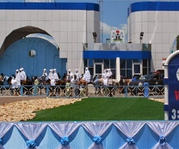
Like most Nigerian states, Niger State is governed by a democratically-elected Governor, who is currently Mohammad Umar Bago. The governor works with the Niger State House of Assembly. The capital city is Minna.
The state has three Senatorial Zones/Districts: Niger East, Niger North, Niger South.
Electoral system
The governor is selected using a modified two-round system. To be elected in the first round, a candidate must receive the plurality of the vote and over 25% of the vote in at least two -third of the State local government Areas. If no candidate passes threshold, a second round will be held between the top candidate and the next candidate to have received a plurality of votes in the highest number of local government Areas.
Major Towns in Niger State
-
Lapai,
Lapai, town and traditional emirate, southeastern Niger state, west-central Nigeria. It lies near the Gurara River, which is a tributary to the Niger River. It was originally inhabited by the Gbari (Gwari) people, who were subject to the Hausa kingdom of Zazzau and, after 1804, to the Fulani emirate of Zaria (to the north).
In 1825 the Fulani requested the emir of Gwandu (Gando), the overlord of the western Fulani emirates, to create a new emirate independent of the emirates of Zaria and Agaie (to the west). Thus the Lapai emirate was founded that same year.
Lapai town was burned after the emirate had given military aid to Bida (50 miles [80 km] west) in its campaign against the British Royal Niger Company in 1897. The emirate was incorporated into Niger province in 1908; and, in 1938, its traditional seat was moved to Badeggi-Lapai (now Badeggi) 9 miles (14 km) west.
Lapai serves as a market centre for the sorghum, yams, rice, millet, shea nuts, peanuts (groundnuts), and cotton grown by the area’s Gbari and Nupe peoples. Swamp rice is cultivated in the floodplains of the Gurara and the Niger rivers. The site of a government dispensary, Lapai is located east of Agaie on the road to Abuja. Pop. (2006) local government area, 110,127.
-
Bida
Bida, town and traditional emirate, Niger state, west-central Nigeria. The town is on the Bako River, a minor tributary of the Niger, and lies at the intersection of roads from Jebba, Zungeru, and Agaie. Originally a small settlement of the Beni (Bini) people, a subgroup of the Nupe, it was captured about 1531 by Tsoede (Edegi), the founder of the Nupe kingdom and the first etsu Nupe (“king of the Nupe people”).
When the kingdom was conquered about 1806 by Fulani warriors, its central region was incorporated as the Nupe emirate in the Fulani empire. Emir Usman Zaki proclaimed himself etsu Nupe in 1835; and, after defeating Umar Bahaushe, a rival Fulani emir, in the Nupe civil war (1847–56) at Bida, he named Bida to replace the emirate’s old capital at Raba (Rabba), 67 miles (110 km) west.
The town wall, which now encloses 5 square miles (13 square km), was begun in the 1850s. During Emir Masaba’s second reign (1859–73), when Nupe became the most powerful kingdom in central Nigeria, Bida’s three royal palaces, the night market, and the central mosque were constructed. Trade relations with the British Royal Niger Company were established in 1871.
Later disputes over both trade and slave dealing led to a British campaign against Nupe and the defeat of the Fulani army at Bida in 1897. The reinstatement by Nupe of the Fulani emir ousted by the company led to British occupation of the town in 1901. Under British rule, Nupe emirate became known as Bida emirate; and in 1908 it was incorporated into the newly created Niger province. Bida’s emir resides in a palace outside the town’s west gate.
Modern Bida is well known for its crafts, notably brass and copper goblets, other metal products, glass beads and bangles, raffia hats and mats, and locally dyed cotton and silk cloth. The craftsmen work by hand on their own premises in distinctive wards and are organized into close-knit guilds.
Most of the town’s predominantly Nupe population live in mud houses that are grouped into customary compounds. The town is the chief collecting point for the swamp rice cultivated in the fadamas (“floodplains”) of the Niger and Kaduna rivers. Bida also trades in yams, sorghum, millet, shea nuts, tobacco, cotton, peanuts (groundnuts), palm oil and kernels, onions, indigo, sugarcane, fruits, goats, sheep, and pottery.
Bida is the site of a federal polytechnic and other colleges. Pop. (2006) local government area, 92,620.
-
Baro
Baro, town and river port, Niger State, west central Nigeria, on the Niger River, 400 miles (650 km) from the sea. Originally a small village of the Nupe people, it was selected by the British as Nigeria’s link between rail and river transport; its solid bank rare along the Lower Niger could be used for loading river craft with Northern Nigeria’s cotton crop. Although the 350-mile (565-km) Baro–Kano railway was completed in 1911, it was shortly eclipsed in importance by a railroad built farther north, and the Baro–Kano line is no longer in use.
From July to March, however, Baro is still used to ship peanuts (groundnuts) and cotton downstream to the Niger Delta ports of Burutu and Warri.
Most of the town’s local trade is in sorghum, yams, rice, millet, fish, palm oil, shea nuts, peanuts (groundnuts), and cotton. Swamp rice is cultivated commercially both by farmers in the vicinity and at the government’s irrigated rice projects at Loguma (10 miles [15 km] northwest) and Badeggi (35 miles [55 km] northwest).
-
Minna
Minna, town, capital of Niger state, west-central Nigeria. Following the opening of the Kano-to-Baro railway (1911) and the extension of the Lagos-to-Jebba line (1915) to a junction in Minna, the town became a major collecting point for agricultural products, including peanuts (groundnuts), cotton, yams, shea nuts, ginger, and rice.
Pigs are also shipped by rail to Lagos. Local trade is mainly in sorghum, yams, corn (maize), millet, peanuts, cotton, shea nuts, indigo, kola nuts, cattle, goats, chickens, and guinea fowl. The town is known for its woven and dyed cotton cloth, raffia mats and baskets, pottery, and brassware. Modern industry includes a brick-making plant.
There is a marble quarry nearby. Since becoming the capital of Niger state in 1976, Minna has developed as an administrative centre. It is home to the Federal University of Technology (1983), teacher-training colleges, and several hospitals. It is also the radio broadcasting centre for the state and is a hub for local roads serving the southern part of the state. Minna is part of the Chanchaga local government area. Pop. (2016 est.) urban agglom., 345,000.
-
Kontagora
Kontagora, town and traditional emirate, northwestern Niger state, western Nigeria, on the south bank of the Kontagora River. Umaru Nagwamatse, an adventurer of the ruling Fulani house of Sokoto (186 miles [299 km] north), was named sarkin sudan (“king of the blacks”) in 1859 by Ahmadu Zaruku, Sokoto’s sarkin musulmi (“commander of the faithful”). Umaru then conquered a region mostly inhabited by the non-Muslim Kamberi people, founded the town of Kontagora (from kwanta gora—“lay down your gourds”) as his kingdom’s headquarters in 1864, and established himself as the first emir of Kontagora.
Throughout his rule, continuing to 1876, he enlarged the emirate by conquests of Kamuku, Kamberi, Dakarki (Dakarawa), Dukawa, Yauri, Nupe, and Gbari (Gwari) towns and captured many slaves. In the first reign (1880–1901) of his son, Emir Ibrahim Nagwamatse, sarkin sudan, Kontagora again became notorious for slave raids that severely depopulated the region and left numerous walled towns in ruins, many of which are still visible (despite a 1949–57 government-sponsored resettlement program).
Ibrahim’s capture of the Zarian town of Birnin Gwari (98 miles [158 km] northeast) in 1899 forced the emir of Zaria to seek the protection of the British, a move that brought the first great Fulani emirate under British control. After Ibrahim threatened the British post at Jebba, 98 miles (158 km) south-southwest, in 1900, British forces occupied Kontagora town (1901) and removed him from office.
Although he was reinstalled as emir in 1903, his territory, which had been incorporated as Kontagora province, and his powers were greatly reduced. When the province was broken up in 1925, the emirate became a separate division of Niger province; it was incorporated into North Western state in 1967, and since 1976 it has constituted an area of 13,219 square miles (34,237 square km) in Niger state.
The town is a collecting point for cotton and peanuts (groundnuts). In addition to these cash crops, Kontagora has considerable local trade in sorghum, millet, cowpeas, tobacco, beans, shea butter, gum arabic, kola nuts, sorghum beer, brass wares, gold artifacts, locally dyed and woven cotton cloth, cattle, goats, chickens, and guinea fowl. Modern industry includes a plant that manufactures plastic sacks. Besides the palace of the sarkin sudan, the town has a federal advanced teacher-training school and a hospital. Kontagora lies on the highway between Jebba and Kaduna and is also a junction for local roads. Pop. (2006) local government area, 151,944.
-
Agaie
Agaie, town and traditional emirate, Niger state, west-central Nigeria. The town lies at the intersection of roads from Bida, Baro, Tagagi, Lapai, and Ebba. Originally inhabited by the Dibo (Ganagana, Zitako), a people associated with the Nupe, it fell under the sway of Malam Baba, a Fulani warrior, in 1822. After Baba had extended his territory south to the Niger River, he requested the emir of Gwandu, the Fulani empire’s overlord of the western emirates, to establish a new emirate; in 1832 Baba’s son Abdullahi was inaugurated as the first emir of Agaie.
Shortly after the chiefs of Agaie emirate had given military aid to Bida (the adjacent Fulani emirate to the west) in its campaign of 1897 against the Royal Niger Company, Agaie was occupied by the British. In 1908 the emirate became part of a newly created administrative unit. Its present population, still predominantly Nupe, is mainly engaged in farming.
Agaie town is a market centre (yams, sorghum, millet, rice, shea nuts, cotton, and peanuts [groundnuts]). Swamp rice, an especially important cash crop south and west of the town in the Niger’s floodplains, is cultivated both on small farms and at the government’s irrigated rice project at Loguma, 20 miles (32 km) south. Area 737 square miles (1,909 square km). Pop. (2006) local government area, 65,209.
-
Suleja
Suleja, town and traditional emirate, Niger state, central Nigeria. The town is situated on the Iku River, a minor tributary of the Niger at the foot of the Abuchi Hills, and lies at the intersection of several roads.
The emirate’s wooded savanna area of about 1,150 square miles (2,980 square km) originally included four small Koro chiefdoms that paid tribute to the Hausa kingdom of Zazzau. After warriors of the Fulani jihad (holy war) captured Zaria (Zazzau’s capital, 137 miles [220 km] north-northeast) about 1804, Muhamman Makau, sarkin (“king of”) Zazzau, led many of the Hausa nobility to the Koro town of Zuba (6 miles [10 km] south).
Abu Ja (Jatau), his brother and successor as sarkin Zazzau, founded Abuja town in 1828, began construction of its wall a year later, and proclaimed himself the first emir of Abuja. Withstanding Zaria attacks, the Abuja emirate remained an independent Hausa refuge. Trade with the Fulani emirates of Bida (to the west) and Zaria began in Emir Abu Kwaka’s reign (1851–77), but, when Abuja’s leaders disrupted the trade route between Lokoja (100 miles [160 km] south-southeast) and Zaria in 1902, the British occupied the town. Alluvial tin mining began in Emir Musa Angulu’s reign (1917–44).
LOCATION
The State Lies On Latitude 80o To 11o:30’ North And Longitude 03o 30’ To 07o 40’ East. The State Is Bordered To The North By Zamfara State, West By Kebbi State, South By Kogi State, South West By Kwara State, North-East By Kaduna State And South East By FCT. The State Also Has An International Boundary With The Republic Of Benin Along Agwara And Borgu Lgas To The North West.
LAND MASS
As At 26th August 1991 (Before The Merger Of Borgu And Agwara Lgas), The State Covered A Land Area Of 74,244 Square Kilometres, Which Is About 8% Of The Total Land Area Of Nigeria. With The Merger, The Land Mass Is Now 76, 469.903 Square Kilometers (About 10% Of The Total Land Area Of Nigeria) Out Of Which About 85% Is Arable.
POPULATION
As At 1961, The Population Of Niger State Was 1,194,508. The 1991 Population Figure Indicates Niger State As Provisionally Containing 2,421,581 People. The 2006 Population And Housing Census Put The State’s Population At 3,950,249.
SOIL
The Soil Types In Niger State Are Two: Ku Soil And Ya Soil. The Ku Soil Has Little Erosion Hazards, While The Ya Soil Has Better Water Holding Capacity.
OCCUPATION
The Majority Of The Populace In The State (85%) Are Farmers While The Remaining15% Are Involved In Other Vocations Such As White Collar Jobs, Business, Craft And Arts.
Religion
The People Of Niger State Are Predominantly Muslims And Christians With Very Few Traditional Religionists And Atheists.
Tribe and Ethnic Division
Although There Are Three Major Ethnic Groups (Nupe, Gbagyi, And Hausa) In The State, Other Tribal Groups Include – Kadara, Koro, Baraba, Kakanda, Ganagana, Dibo, Kambari, Kamuku, Pangu, Dukkawa, Gwada And Ingwai. Niger State Also Has Numerous Settlers From Other Parts Of The Country Living Peacefully And Contributing Their Quota To The Development Of The State.
Economy
The Cherished Asset Of Niger State Is Its Fertile Land, However, The Potentials Are Yet To Be Fully Explored. The Climate And Availability Of Wide Variety Of Mineral And Agricultural Resources Also Attest To The Economic Potentials Of The State. Every Government That Has Come To Power Endeavoured To Provide Good Infrastructure Such As Roads, Electricity, Water And Communication Facilities, To Make Way For Interested Investors. Some Natural And Mineral Resources Found In The State Include: Talc, Gold, Ball Clays, Silica, Sand, Marble, Copper, Iron, Felsper, Lead, Kaolin, Casserole, Columbite, Mica, Quartzite, And Limestone. The Three Hydro Electric Power Stations In The Country (At Kainji, Jebba And Shiroro) Are All Situated In Niger State.
Tourism
Niger State Is One Of The Richest States In The Country In Terms Of Tourism. Some Of The Tourist Attractions Are Zuma Rock, Gurara Falls, Baro Empire Hill, Lord Lugard Colonial Ruins At Zungeru, Nagwamatse Well And Kainji Lake National Park.
Climate
Niger State Experiences Distinct Dry And Wet Seasons With Annual Rain Fall Varying From 1,100mm In The Northern Parts To 1,600mm In The Southern Parts.
The Maximum Temperature (Usually Not More Than 94oc) Is Recorded Between March And June, While The Minimum Is Usually Between December And January. The Rainy Seasons Last For About 150 Days In The Northern Parts To About 120 Days In The Southern Parts Of The State.
Generally, The Fertile Soil And Hydrology Of The State Permits The Cultivation Of Most Of Nigeria’s Staple Crops And Still Allows Sufficient Opportunities For Grazing, Fresh Water Fishing And Forestry Development.
Industrialization
The Government Of Niger State Is Aware That The True Development Of Any Nation Depends On Her Level Of Industrialization. For This Reason Concerted Efforts Have Been Made To Ensure Rapid Industrialization. Being Largely An Agrarian State, Niger State Can Support A Large Variety Of Agro-Allied Industries. Also, The State’s Numerous Mineral Resources Can Serve As Basis For The Establishment Of Many Other Industries In The State.
In Order To Induce Industrialists To Invest Heavily In Tapping These Resources, Government Has To Put In Place Many Incentives Such As Provision Of Well-Serviced Industrial Layouts, Guaranteed Accelerated Processing Of Application For Industrial Plots And Even Financial Assistance In Form Of Loans And Equity Participation By The Government In Certain Cases.
Other Facilities Like Telecommunication, Postal Services Etc. Are Adequately Provided In The State For Effective Business Contacts. The State Has International Airport And Is Well Linked To All Parts Of Nigeria By Road And Rail.
Electricity Supply
Niger State Is The Acclaimed “Power House” Of The Nation Because It Houses The Three Hydro-Electric Dams: Shiroro Hydro-Electric Dam; Kainji Hydro-Electric Dam; And Jebba Hydro-Electric Dam. It Is A Fact That All Major Towns In The State And Indeed All Local Government Headquarters Except Few Are Connected To The National Grid.
Electoral system
The governor is selected using a modified two-round system. To be elected in the first round, a candidate must receive the plurality of the vote and over 25% of the vote in at least two -third of the State local government Areas. If no candidate passes threshold, a second round will be held between the top candidate and the next candidate to have received a plurality of votes in the highest number of local government Areas.
Education in Niger State
Niger State is home to several reputable tertiary institutions that provide quality education and training across various fields. These institutions contribute significantly to the intellectual and professional development of students in the state and beyond. Some of the notable tertiary institutions in Niger State include:
-
Federal College of Education, Kontagora
- The Federal College of Education (FCE), Kontagora, is a leading institution dedicated to training qualified teachers for primary and secondary schools. The college offers diploma and degree programs in education, in affiliation with universities, to enhance teacher training and professional development.
-
Federal Polytechnic, Bida
- Established in 1977, the Federal Polytechnic, Bida, is one of Nigeria’s top polytechnics, offering programs in engineering, science, technology, business, and management studies. The institution plays a vital role in equipping students with practical skills and technical knowledge for various industries.
-
Federal University of Technology, Minna (FUTMinna)
- The Federal University of Technology, Minna (FUTMinna) is a prestigious institution known for its strong focus on science, technology, and engineering education. Established in 1983, the university is renowned for its research and innovation in fields such as engineering, environmental technology, information technology, and applied sciences.
-
Ibrahim Badamasi Babangida University, Lapai (IBBUL)
- Ibrahim Badamasi Babangida University (IBBUL), located in Lapai, is a state-owned university named after Nigeria’s former head of state, General Ibrahim Babangida. Established in 2005, the university offers undergraduate and postgraduate programs across various disciplines, including humanities, sciences, and social sciences.
-
Niger State College of Education, Minna
- The Niger State College of Education, Minna, focuses on training educators to meet the growing demand for qualified teachers in the state and the country. The college offers National Certificate in Education (NCE) programs and professional development courses in various fields of education.
-
Niger State Polytechnic, Zungeru
- Niger State Polytechnic, Zungeru, is a state-run polytechnic providing vocational and technical education in disciplines such as engineering, technology, business administration, and applied sciences. The institution is committed to producing skilled graduates equipped for employment and entrepreneurship.
These institutions play a crucial role in advancing education, research, and technological development in Niger State. With a combination of universities, polytechnics, and colleges of education, the state provides a diverse range of academic and professional opportunities for students.
Transport
Federal Highways are:
- A1 north from Ilorin in Kwara State across the Niger River by a four-lane bridge at Jebba for 388 km as part of the African Unity Road (TAH2: Trans-African Highway 2) to Kontagora, then via Ibeto to Yelwa in Kebbi State.
- A125 continuing TAH2 east from A1 at Kontagora via Tegina to Kaduna State at Gishiri.
- A124 east from A1 north of Mokwa via Bida and Agaie as the Bida-Abuja Rd to Abuja, FCT at Kudan.
Two roads to Benin:
- The Wana-Babana Rd at Babana to Basso.
- Agwara Tungar Jatau Swate Maje Rd from Agwarra via Konkwesso to RNIE 7 to Ségbana.
Other Major Roads include:
- The Minna-Tagbari Rd northeast to Kaduna State as the Chibian-Zazaga-Sarkin Pawa Rd
- The Minna-Bida Rd
- The Mararaba-Makutu-Mapi Rd southeast from Minna via Matumbi and Paiko to A124 at Daga
- Yelwa-Mokwa Rd across the Niger River by a bridge from Kato to Jinjima
Railways:
- the Western Line north from Lagos via Ibadan and Ilorin across the Niger River at Jebba by a 547 m bridge (1915) via Minna to Kaduna, with a branch line from Minna 155 km to the port of Baro on the Niger River, which is connected with Kano by the Northern Line.
Airports:
- Minna Airport
Natural Resources in Niger State
Niger State is rich in a variety of natural resources, making it one of Nigeria’s most resource-endowed states. These resources contribute significantly to the state’s economic potential, supporting industries such as mining, agriculture, and energy production. Below are some of the key natural resources found in Niger State:
-
Uranium
- Niger State has uranium deposits, which are valuable for nuclear energy production. With proper exploration and investment, this resource could significantly contribute to Nigeria’s energy sector.
-
Coal
- The state has coal reserves, which can be used for power generation, industrial production, and as an alternative energy source.
-
Gold
- Gold mining occurs in parts of Niger State, attracting small-scale and artisanal miners. The potential for commercial gold mining could boost the state’s economy and Nigeria’s mineral exports.
-
Iron Ore
- The state possesses iron ore deposits, a critical raw material for steel production. The availability of iron ore supports Nigeria’s goal of developing a strong steel industry.
-
Tin
- Tin deposits in Niger State contribute to Nigeria’s mining sector, as tin is widely used in electronics, soldering, and alloys.
-
Phosphate
- Phosphate minerals are found in Niger State and are essential for fertilizer production, making them vital for agricultural development.
-
Crude Oil
- There are reports of crude oil deposits in parts of Niger State, which, if fully explored and developed, could enhance Nigeria’s oil production capacity.
-
Molybdenum
- Molybdenum, a rare but valuable mineral used in steel production and industrial applications, has also been discovered in Niger State.
-
Salt
- Niger State has salt deposits, which are crucial for food processing, chemical production, and industrial use.
-
Gypsum
- The state contains gypsum deposits, an essential material in cement production, construction, and plaster manufacturing.
With its abundant mineral resources, Niger State has the potential to become a key player in Nigeria’s mining and industrial sectors. However, proper investment, sustainable exploration, and infrastructure development are required to maximize these resources for economic growth.
Geography
Climate
The state has very warm climate with a yearly average of 34° Celsius. It is warm or hot all year, but there are few typically tropical and sultry months, although humidity is sometimes uncomfortably high in June to September. The best time for traveling is from November to April, when there is less rain. The rainiest days occur in May to October. September has the rainiest days, and December the least. January is the sunniest month, and August the least sunny.
Business Environment And Competitiveness
Vision
“A Dynamic Fast Growing Competitive Business Environment With A Productive Base That Would Be Ranked Among The Top Three State Economies In Nigeria By 2020”
Goal
To Empower The Private Sectors Operators To Be Transparent, Adhere To Due Process And Best Practices By 2020.
Objectives
- Reduce And Ease The Cost Of Doing Business In Niger State.
- Empower The Businesses Through Patronage
- Organize The Sector Into Trade Groups And Associations To Encourage Cooperation Among Them.
- Support The Sectors’ Promotional Programmes And Encourage Social Responsibility.
- Sustain And Promote Domestic Investments And Become An Important Link In National Supply Chain.
- Reduce Business Related Corruption And Sharp Unethical Practices.
- Attract Local And Foreign Investments.
Mandate Of Business Environment And Competitiveness
- To Ensure That All Companies In Niger State Are Socially Responsible By 100% By 2020
- To Achieve A Competitive Business Environment In Niger State By The Year 2020
Conclusion
Niger State, the largest state in Nigeria by landmass, holds significant historical, economic, and cultural importance. It is known for its agricultural productivity, housing major dams like Kainji and Shiroro, and its rich cultural heritage, with diverse ethnic groups such as the Nupe, Gwari, and Hausa. The state also plays a vital role in Nigeria’s power generation and agriculture.
Despite its potential, challenges like infrastructure development, security concerns, and educational advancement need to be addressed for sustainable growth. With continued investment in agriculture, energy, and education, Niger State can further contribute to Nigeria’s overall development while improving the standard of living for its residents.
Business Amenities
- Car Parking
-
 Government Organisation
- Profile
Contact Information
Opening Hours
Contact Business
Contact Business
Additional Information
Additional info


Subscribe now to get direct updates
Join Naijadirectory Newsletter